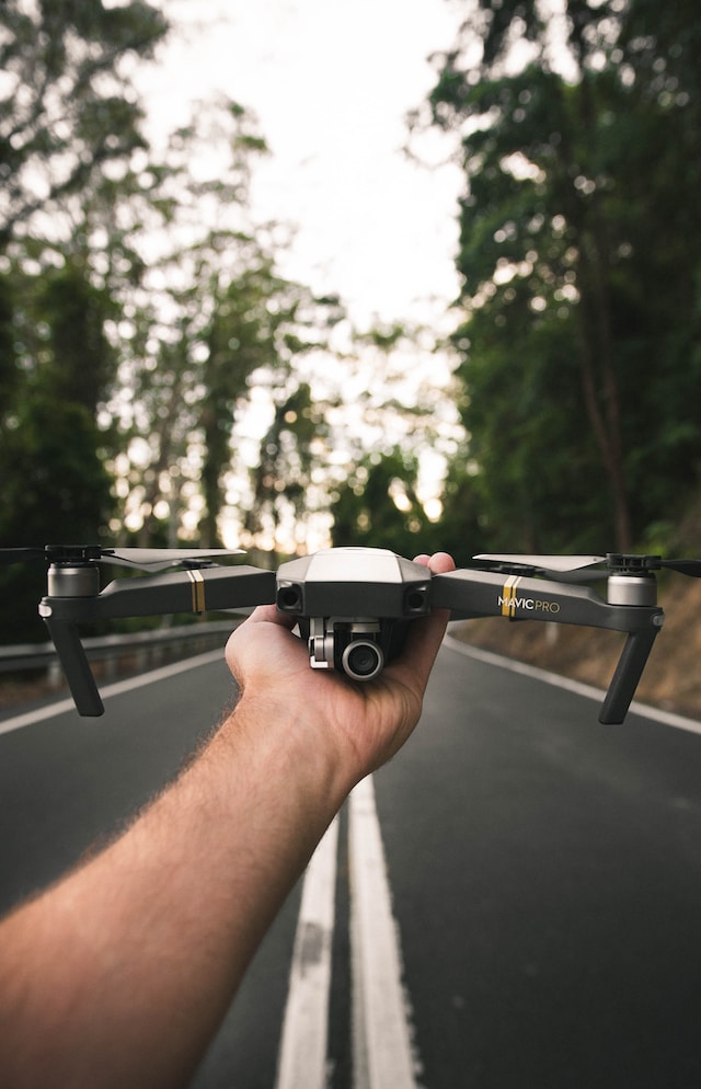
The realm of transportation and infrastructure is undergoing a revolution, thanks to the soaring advancements in drone technology. Unmanned aerial vehicles, commonly known as drones, are rapidly reshaping the way we plan, build, and maintain our infrastructure. From surveying expansive landscapes to optimizing traffic management, drones are proving to be indispensable tools that bridge the gap between innovation and implementation.
On a global scale, the potential value of drones is assessed at approximately USD 19.89 billion in 2022 and is expected to grow at a compound annual growth rate (CAGR) of 13.9% from 2023 to 2030. In Europe, projections indicate that drone valuation could soar to EUR 10 billion by 2035 and subsequently exceed EUR 15 billion on an annual basis by 2050. In the United Kingdom, the integration of drones is envisioned to yield significant productivity enhancements across various sectors, culminating in potential net cost savings of up to £16 billion by 2030.
In this article, we’ll delve into the top 3 uses of drones in the transportation and infrastructure sectors and how they are elevating these industries to new heights.
1. Aerial Surveying and Mapping:
Drones have brought a paradigm shift to the traditional surveying and mapping methods used in the transportation and infrastructure sectors. Equipped with high-resolution cameras and LiDAR sensors, drones can capture accurate topographical data, create 3D models, and generate detailed maps. These capabilities streamline the planning and design phases of infrastructure projects, providing engineers and planners with crucial insights into the terrain, potential obstacles, and optimal pathways.
Employing drones for mapping and surveying yields a multitude of advantages:
Enhanced Speed: Drones can swiftly cover expansive acres of land, accomplishing what would take manual ground surveys significantly more time. This rapid data collection is particularly beneficial in areas characterized by rugged terrains or challenging landscapes.
Cost Efficiency: The efficiency of drones in data capture translates to reduced operational expenses. The ability to swiftly gather data in a safe manner contributes to potential cost savings, making the overall process more budget-friendly.
Minimized Operational Hazards: Leveraging drones to collect topographical site data eliminates the necessity for surveyors to be physically present on-site or venture into perilous areas to acquire information. This mitigates operational risks, enhancing safety measures, especially in hard-to-access locations.
Elevated Data Quality: Drones operate ceaselessly, generating a multitude of measurements. This continuous scanning results in remarkably detailed and highly precise point files, often accurate down to a few millimeters, especially when combined with traditional survey techniques. This amalgamation ensures an unparalleled quality of data.
2. Infrastructure Inspection and Maintenance:
Maintaining vast networks of roads, bridges, and utility systems is a complex challenge. Drones are revolutionizing infrastructure inspection by enabling quick and efficient visual assessments. With advanced imaging capabilities, drones can closely examine structures for signs of wear, corrosion, or damage, all while minimizing the need for human inspectors to undertake risky tasks. This leads to proactive maintenance, enhanced safety, and extended infrastructure lifespan.
Maintaining the intricate web of infrastructure that sustains the United States’ $20 trillion economy presents formidable challenges. The task becomes even more daunting as economic growth surpasses the capacity of existing infrastructure. For every new road constructed, several others deteriorate at an accelerated pace. The strain on the system is evident, with a staggering 25% of bridges classified as “deficient” and the workforce under immense strain.
However, the integration of advanced technologies offers a glimmer of hope for bridging the infrastructure gap. Drones emerge as a solution that alleviates the workload on infrastructure workers while simultaneously enhancing risk management, saving time, and reducing expenses. To comprehend the significance of drones in the infrastructure sector, consider the following five compelling statistics:
Enhanced Inspection Efficiency: Drones outshine traditional inspection methods, such as helicopters, by identifying over 20% more critical issues. This advantage proves especially vital in wildfire mitigation efforts. Drones offer detailed insights into remote and otherwise inaccessible areas, aiding timely repairs and averting potential disasters. The use of drones streamlines inspections, boosting efficiency and accuracy. Digital platforms like DroneUp facilitate seamless storage of georeferenced inspection records, simplifying regulatory compliance.
Tripled Field Inspection Speed: Drones accelerate field inspections threefold by rapidly capturing comprehensive aerial data. This efficiency extends to vegetation encroachment monitoring, a crucial facet of wildfire prevention. With drones, you gain precise data through point clouds, minimizing human error and fostering informed decision-making. The technology not only enhances insights but also minimizes risks and safeguards team members.
Exponential Tower Scanning: Drone operators can scan three times more towers in the same time it takes a climber to inspect one. Telecommunication companies leverage drones to expedite inspections, bolstering network reliability through efficient data collection. The scalability of drones permits nationwide tower inspections with AI-enhanced analytics.
Efficiency in Bridge Inspections: Drones require a mere one-sixth of the labor hours compared to manual inspections. Aging infrastructure poses both economic and safety threats. Drones enable comprehensive and rapid inspections, reducing the risk for infrastructure workers navigating hard-to-reach areas. Novel perspectives and 360° views empower experts to analyze drone footage without jeopardizing their safety.
Resource Efficiency: Drones consume up to 87% less manpower and resources per mile inspected. In regions prone to natural disasters, time-critical data collection is paramount. Drones expedite response efforts, locating issues swiftly and ensuring efficient evacuation procedures. These devices prove invaluable in hazardous environments, ensuring safe assessment of otherwise inaccessible damage.
3. Construction Site Monitoring:
As per a McKinsey report, the construction sector and its associated expenditures contribute to 13% of the global economy’s GDP. While various industries have shown remarkable improvements in productivity, the construction sector’s annual productivity growth has merely seen a 1% increase annually over the past two decades. McKinsey’s analysis has highlighted seven potential avenues that could elevate construction productivity by an impressive 50% to 60%. One notable strategy involves integrating enhanced technology and innovation into the construction domain. Drones, when applied in construction, serve as a prime illustration of innovative technology that can substantially enhance project timelines, concurrently reducing the necessity for substantial capital investments and skill prerequisites.
Advantages of drones in the construction industry
The benefits of drone surveying for construction firms can be categorized into four key areas: enhanced efficiency, cost reduction, elevated safety standards, and improved data precision.
Enhanced Efficiency: Traditional manual surveying of construction sites is a labor-intensive and time-consuming process. It demands a specialized skill set, financial resources, and the potential for redoing surveys in case of errors. By contrast, drone surveying revolutionizes this efficiency equation. In comparison to the approximate five acres surveyed per hour through conventional methods, drone surveying empowers even novice surveyors to cover a staggering 120 acres per hour. This represents a remarkable 60-fold advancement in surveying efficiency.
Cost Reduction: Drone surveying offers a compelling advantage in cost efficiency. Traditional survey methods require substantial manpower, equipment, and materials, leading to considerable expenses. Drone technology minimizes the need for extensive labor and resources, translating into significant cost savings for construction companies.
Elevated Safety Standards: Traditional surveying often necessitates surveyors to access potentially hazardous or hard-to-reach areas. Drone surveying circumvents this risk by providing a safe, aerial vantage point. This not only safeguards surveyors from potential dangers but also contributes to an overall improvement in on-site safety standards.
Improved Data Precision: Precision is paramount in construction surveying. Drones utilize advanced technology to capture detailed data with remarkable accuracy. The collected data can be analyzed with precision, allowing construction companies to make informed decisions based on highly reliable information.
By leveraging drone surveying, construction companies gain a transformative edge in terms of efficiency, cost-effectiveness, safety, and data accuracy, thereby revolutionizing the way construction projects are executed and managed.
Conclusion
Drones are propelling the transportation and infrastructure sectors into a new era of innovation and efficiency. As these versatile aerial tools continue to evolve, they are reshaping the way we build, maintain, and manage our physical infrastructure. Drones are proving to be indispensable assets that enhance the safety, sustainability, and functionality of our modern world. As we embrace these transformative technologies, we can expect even more groundbreaking applications that will redefine the future of transportation and infrastructure.


